
Surveys
- Aerial, Drone and Photogrammetric Control
- ALTA/NSPS Land Title Surveys (ALTA)
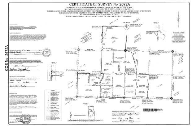
- Boundary Line Adjustments
- Building and Home Layout
- Cellular Towers; Location and As-Built
- Corridors
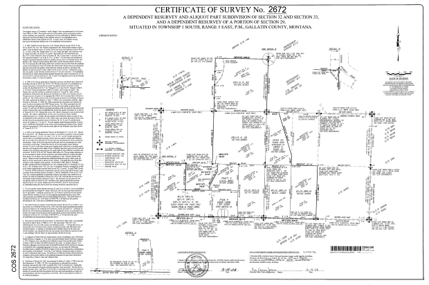
- Dependent Resurveys
- Elevation Certificates
- Easements
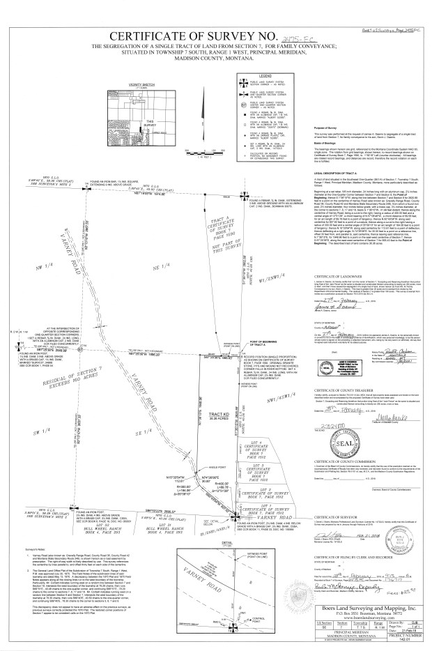
- Family Transfers
- Fence Location and Verification
- Geographic Coordinate Database (GCDB)
- Homestead Entry Surveys
- Line Posting
- Major Subdivisions
- Mapping; General
- Mineral Survey Retracement
- Minor Subdivisions
- Oil and Gas Location
- Retracement Surveys
- Special Boundary Problems
- Topographic Surveys
- Tree Surveys; Location
- Utility Sites
Example Surveys
Resurveys
Generally, this survey is performed to identify the current state of the property and reports found corners and measurements compared to originally described corners and measurements. This survey is used to identify underlying Tracts of Record.
Boundary Line Adjustments
This survey is used for estate planning, property enhancement, resolving issues and generally reconfiguring lines.
Mortgage Surveys
This survey delineates a tract of land used to secure financing. Lenders often require this survey and provide criteria for mapping critical features.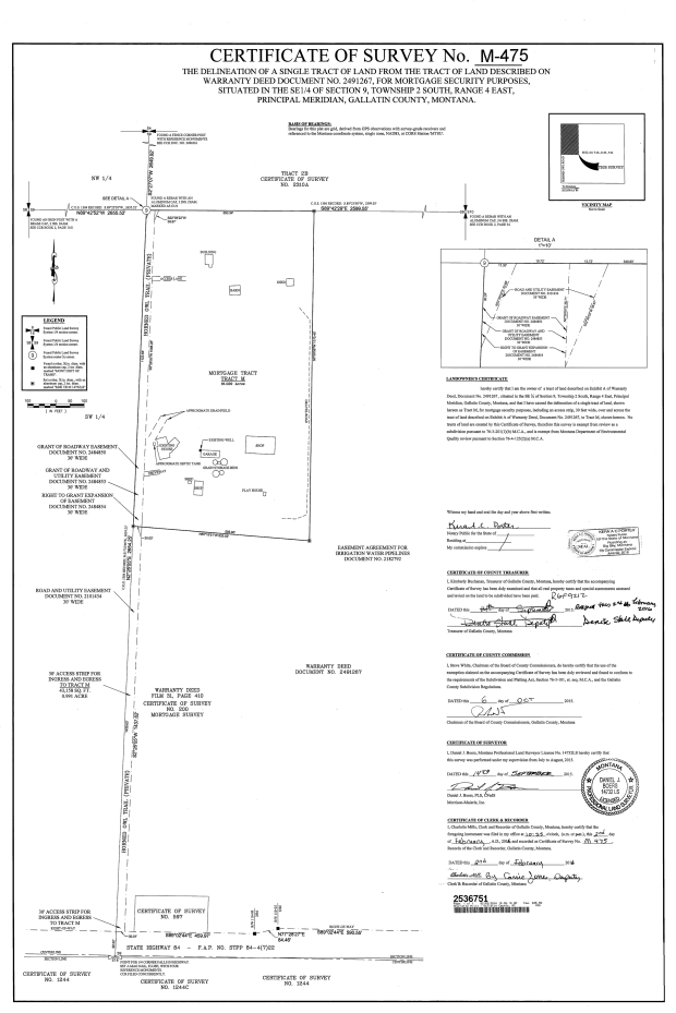
Family Transfer
This survey is performed to segregate tracts of land for transfer to immediate family (father, mother, son, daughter, spouse). Title to land must reflect ownership by a person, not an entity, in order to transfer. Land owner’s possess the right to perform this division, whereas a subdivision is a privilege and permission must be granted. Generally, there are specific rules that apply to this type of division.
Major Subdivision
This is the division of land creating six or more lots for sale.
Minor Subdivision
This is the division of land into five or fewer lots.
